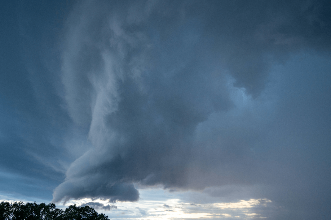
Cyclone Ditwah Intensifies: Heavy Rain, Storm Warnings Issued for Tamil Nadu, Andhra Pradesh, Kerala. Salt in the air, traffic sirens in the distance, shop shutters half down already. The system tightened over the Bay, and coastal towns started feeling that damp chill. People checked roofs, charged phones. Small steps first, always — this is the pulse of Latest News in India unfolding in real time.
Cyclone Ditwah: Current Status and IMD Alert Overview
Cyclone Ditwah holds a steady core tonight, with organised bands pulling moisture inland. IMD alerts remain active for Tamil Nadu, Andhra Pradesh, and Kerala, with specific districts under Red or Orange for heavy to extremely heavy rain. Wind forecasts point to strong gusts along open coastlines, squalls near harbours, and very rough sea conditions.
Fishermen advisories continue. Schools in some pockets move to holiday mode. It sounds routine on paper, yet the rain thumps like drums on bus shelters. That is how it builds.
How Cyclone Ditwah Formed and Why It Intensified Over the Bay of Bengal
A low set up over warm waters and gathered speed as surface temperatures stayed supportive. Vertical wind shear stayed moderate for long enough, so the circulation stacked better and clouds kept wrapping around the centre. Moist inflow from the southeast fed the core, and the pressure fell in a clean stair-step pattern.
Not spectacular, just textbook. Mariners noticed earlier white streaks on waves, a small tell. Satellite loops showed curved rain bands, drier slots closing. Feels like work the ocean knows by heart.
District-Wise Rainfall & Alert Levels (Tabular Column)
| State | Districts under higher alert | Rain intensity trend | Advisory note |
| Tamil Nadu | Chennai, Chengalpattu, Cuddalore, Nagapattinam, Villupuram | Heavy to very heavy at times | Monitor subways, avoid seafronts |
| Andhra Pradesh | Tirupati, Nellore, Prakasam, Chittoor | Very heavy with squalls | Cover paddy, keep pumps ready |
| Kerala | Thiruvananthapuram, Kollam, Alappuzha, Ernakulam, Kottayam | Heavy with thunderstorms | Watch hilly roads, treefall risk |
Numbers will flex by bulletin timing. People cross-check with local alerts, always smarter.
State-Wise Impact Forecast for Tamil Nadu, Andhra Pradesh, and Kerala
Tamil Nadu braces for intense spells along the north and central coast. Chennai’s low-lying pockets may see waterlogging during peak bursts, with subways and underpasses responding first. Delta districts keep pumps ready, and power crews stand by for line faults.
Andhra Pradesh expects heavy rain over south coastal stretches and parts of Rayalaseema. Paddy kept for drying needs quick cover, a polythene sheet does more than people think. Urban junctions near canals could slow to a crawl. That’s the usual pattern.
Kerala lines up for steady, at times thundery rain across coastal and midland zones, with hilly areas on watch for slumps of soaked soil. Narrow roads under tree cover turn slippery fast. Locals know the smell of wet laterite, sharp and earthy.
Timeline: When the Heaviest Rain and Winds Will Hit Each Region
Early phases show outer bands scraping the coast with squalls. The thick core follows, timing still a little tight but pointing to tonight into tomorrow for the worst over north Tamil Nadu and south Andhra Pradesh. Kerala’s peak aligns with the southern arcs crossing the coastline during the same window, then easing into patchy but stubborn showers.
Interior districts catch spillover the next day. The final act often looks messy, trailing showers that unsettle routines even after the headline passes.
Expected Hazards: Flooding, High Winds, Rough Seas, and Travel Disruptions
People can expect:
- Short, violent downpours that fill streets, then drain slowly.
- Strong gusts that nudge hoardings and snap weak branches.
- Port closures or restrictions, fishing halted, beach zones cordoned.
- Flight delays, diversions, and later, backlog. Train schedules stretch.
- Power cuts in pockets, not everywhere, yet enough to test patience.
One more point. Stormwater mixes with debris and leaves. That clogs gratings, and it is boring work to clear, but it saves basements.
Government Preparedness: SDRF Deployment, Evacuations, and Emergency Measures
State teams moved equipment to staging yards close to risky stretches. SDRF units pre-positioned boats, rescue gear, inflatable lighting, and tree cutters. Control rooms share rainfall and discharge data with district offices. Temporary shelters open in schools and community halls, with drinking water, dry rations, ORS packets.
Health teams map dialysis patients and oxygen needs. Municipal squads reinforce embankments with sandbags near drains that misbehave every season. The checklist looks long, and still someone will need a spare torch at 2 am. Happens every time.
FAQs on Cyclone Ditwah and Region-Wise Safety Guidelines
Q1. How should coastal households in Tamil Nadu plan tonight if streets already hold water in front?
Keep valuables lifted, switch off ground plug points, store drinking water, and avoid stepping into pooled lanes that hide open inspection covers, patience helps here.
Q2. What can small farmers in Andhra Pradesh do for harvested paddy during this rain phase?
Shift sacks to raised planks, use plastic sheeting with side weights, check moisture early morning, and keep contact handy for procurement centre guidance.
Q3. Are hill routes in Kerala safe during and after the core rainbands pass through?
Travel only for essentials, watch recent cut slopes, avoid parking below leaning trees, and wait for PWD clearance updates after heavy bursts settle.
Q4. What essentials should families keep ready if the locality loses power for several hours?
Charged lights, battery bank, basic medicines, dry food, safe water, and a small radio, simple kit yet it cuts stress for children and elders.
Q5. When will normal city services likely stabilize once the system weakens and moves inland?
Stormwater clears in stages, airports clear backlog next, then buses and suburban trains catch rhythm, usually a day or so after peak rain ends.


