

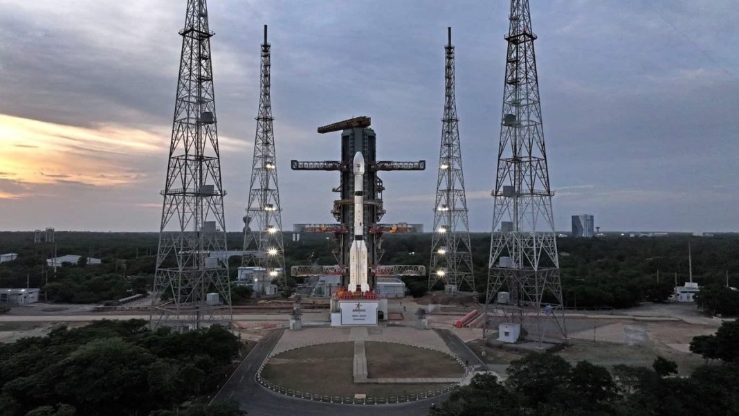

India has gained a new kind of eye over the subcontinent. ISRO successfully launched EOS-05 aboard GSLV-F17 from Sriharikota at 2:55 am IST on September 4, 2026, placing the 2,367 kg Earth-observation spacecraft into its intended sub-geosynchronous transfer orbit. The satellite is designed to later operate from geosynchronous orbit, roughly 36,000 km above Earth, where it can repeatedly watch the same broad region instead of waiting for another low-orbit pass. ISRO’s GSLV-F17/EOS-05 mission page confirms the successful launch and intended-orbit placement.
That high-frequency view is the real headline. Mission-profile reporting says EOS-05 could provide broader imagery about every 30 minutes and revisit selected priority targets in around five minutes. For floods, cyclones, forest fires, landslides and other fast-changing events, those extra snapshots could give agencies a much tighter timeline of what is changing on the ground.
What Happened In The GSLV-F17 EOS-05 Mission?
ISRO confirmed that GSLV-F17 completed its mission and placed EOS-05 into the intended orbit. The flight was the 19th mission of India’s Geosynchronous Satellite Launch Vehicle. ISRO’s official mission brochure lists a nominal transfer orbit of 170 km perigee and 28,934 km apogee, with EOS-05 weighing about 2,367 kg. ISRO Chairman V. Narayanan later said the satellite was healthy after the precise injection.
The transfer orbit is only the first leg. EOS-05 must use onboard propulsion to move toward its final geosynchronous operating position. ISRO calls it India’s first imaging satellite from geosynchronous orbit, a major change from Earth-observation spacecraft that sweep over India from much lower altitudes.
Key mission points include:
- Launch: September 4, 2026, at 2:55 am IST from Sriharikota.
- Rocket: GSLV-F17, the 19th GSLV flight.
- Payload: EOS-05, an advanced Earth-observation satellite weighing about 2,367 kg.
- Initial destination: Sub-Geosynchronous Transfer Orbit before movement toward its operational orbit.
- Core role: Frequent imaging for natural resources, disaster events and persistent observation.
ISRO also posted mission-success photographs through its official X account shortly after the launch.
Why Can EOS-05 Revisit Priority Targets In Just Minutes?
Most imaging satellites in low Earth orbit move quickly over the planet. They may deliver sharper pictures, but a specific location has to wait for the spacecraft to pass overhead again. EOS-05 takes the opposite approach. From geosynchronous altitude, it remains positioned to keep India and nearby regions within a broad, recurring field of view.
That lets operators trade some spatial detail for much faster temporal coverage. Reports on the mission profile put routine regional imaging near 30-minute intervals, while a selected high-priority location could potentially be revisited in about five minutes. During a cyclone landfall or a rapidly expanding flood, repeated images can show direction, spread and change rather than one isolated frame.
Why A Five-Minute Revisit Could Change Disaster Response
The National Remote Sensing Centre already runs near-real-time flood and cyclone monitoring, forest-fire services, landslide products and the National Database for Emergency Management. EOS-05 could feed a faster stream of observations into that wider system, especially when conditions shift several times within a single hour.
For responders, the useful shift is not simply “more images.” It is a shorter gap between observations. A breached riverbank, new inundation pocket, spreading fire front or damaged corridor could be checked again before conditions move far beyond the previous satellite image.
Could EOS-05 Transform India’s Real-Time Disaster Monitoring?
Potentially, yes, but it will work best as part of a network rather than as a standalone warning machine. ISRO’s earlier technical descriptions say the EOS-05 concept was built for near-real-time imaging of natural resources and disaster events at frequent intervals. NRSC’s disaster-management programme already shares space-based inputs with central and state disaster agencies through NDEM.
The new satellite could therefore improve the “watch again quickly” part of emergency mapping. That may help during monsoon flooding, cyclone landfalls, coastal emergencies, forest fires and sudden slope failures, particularly when officials need to compare conditions repeatedly during the same hour.
There are limits. Optical and infrared observations can be affected by cloud cover, and a satellite image alone cannot replace weather radar, river gauges, field reports or all-weather synthetic-aperture radar missions. EOS-05 should complement those systems, not replace them. Its biggest contribution may be persistent regional observation combined with existing forecasting, mapping and response tools. ISRO’s earlier programme description specifically framed EOS-05 imaging around cloud-free conditions.
The launch also closes a long technical loop. EOS-03, the earlier geostationary imaging attempt, was lost during the GSLV-F10 mission in August 2021. Five years later, EOS-05 has reached orbit successfully. If commissioning confirms the planned rapid-revisit performance, India will have a new way to watch fast-moving disasters unfold almost frame by frame.
FAQs About ISRO EOS-05
What Is EOS-05?
EOS-05 is India’s first geosynchronous-orbit imaging satellite, built for frequent Earth observation over priority regions.
How Often Can EOS-05 Image India?
Mission reports indicate regional imaging every 30 minutes, with priority targets revisited about every five.
Is EOS-05 Already At 36,000 Km?
No. GSLV-F17 first placed it in transfer orbit before onboard propulsion raises its operational altitude.
Can EOS-05 See Through Clouds?
Thick cloud can obstruct it; radar satellites remain valuable for all-weather disaster observation during emergencies.
Will EOS-05 Replace India’s Existing Disaster Systems?
No. It should strengthen satellite, radar, forecast, mapping and field-response systems with faster repeat imagery.