

India’s 2026 southwest monsoon is entering September with conflicting signals: the country has received less rain overall, yet several regions are still seeing very heavy spells. The India Meteorological Department expects September rainfall to remain below normal, while the World Meteorological Organization’s latest El Niño update says the El Niño established in the tropical Pacific will likely strengthen and persist into early 2027.
“Super El Niño” is not an official WMO category. WMO describes the event as likely to become “very strong”. Its latest seasonal models show an unusually large Niño 3.4 temperature anomaly, raising concern about a hotter, more uneven finish to India’s monsoon.
Key Highlights
- India’s August rainfall was about 16% below normal after a very dry monsoon start.
- IMD expects September rainfall below normal, at less than 91% of the long-period average.
- WMO sees a near-100% likelihood of El Niño lasting through February 2027.
- Research suggests El Niño can bring more dry days while increasing extreme-rainfall risk in parts of India.
- Farms, reservoirs and flood-prone cities could face very different conditions during the same season.
What Has Changed In India’s 2026 Monsoon?
By the end of August, India’s cumulative monsoon rainfall was roughly 14% below normal. June produced the biggest early shortfall, July brought a partial recovery, and August slipped back into deficit. The IMD September rainfall outlook points to another below-normal month, increasing the chance that the June-September season finishes deficient.
That does not mean every state will stay dry. On September 3, IMD warned of very heavy rain over parts of Madhya Pradesh, including isolated extremely heavy falls in eastern Madhya Pradesh, while rainfall over peninsular India was expected to remain subdued.
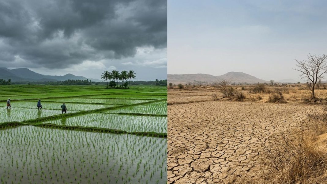
A national deficit is an average across a vast country. It can coexist with flooding in one district and dry fields a few hundred kilometres away.
An official IANS post on X earlier this year also carried IMD Director-General Mrutyunjay Mohapatra’s warning that India’s 2026 monsoon was likely to receive below-normal rainfall.
Why Can El Niño Cut Total Rain Yet Intensify Downpours?
El Niño warms the central and eastern equatorial Pacific and shifts large-scale atmospheric circulation. For India, that often weakens monsoon flow and reduces widespread rainy days. But weaker seasonal rainfall does not automatically mean weaker individual storms.
A 2025 Science study, highlighted by IIT Madras’ Shaastra magazine, found that El Niño summers can produce more extreme rainfall days across parts of India’s core monsoon zone and the Western Ghats. Researchers found more dry or weak-rain days overall, but stronger extremes when favourable systems developed. Extreme heavy-rainfall days could be at least 50% more likely in some regions during El Niño years than La Niña years.
One proposed reason is that low-pressure systems can shift tracks while warm, moisture-rich air builds instability. When that moisture is lifted rapidly, rain can arrive in a short burst instead of being spread across several days.
Climate warming adds another factor. Warmer air can carry more water vapour, raising the rainfall potential of storms that do form. Long-term research on central India’s extreme rainfall has found rising widespread extreme-rain events alongside weaker seasonal rainfall trends.
Where Are The Biggest Risks For Farms And Cities?
For agriculture, timing may be as important as the seasonal total. Cotton, soybean, maize and pulses need moisture during critical crop stages, while winter crops depend on soil moisture left after the monsoon. A dry September can hurt fields even if a nearby town receives one damaging downpour.
Cities face another problem. Short, heavy rain can overwhelm drains, roads and low-lying neighbourhoods before the monthly total looks unusual. Reservoir managers must also handle shortages and sudden inflows when rainfall is concentrated into fewer episodes.
The regional picture will remain uneven. The southern peninsula entered September with a large deficit, while parts of eastern and central India have seen active rain systems. A developing positive Indian Ocean Dipole may alter regional rainfall, but it is not guaranteed to cancel El Niño’s influence.
What Comes Next For India?
WMO’s September-November 2026 seasonal climate update forecasts the Niño 3.4 anomaly near 3.6°C for September-November, with strengthening expected toward November and December. It also gives a nearly 100% probability that El Niño will continue through February 2027.
For India, the immediate threat is not simply “drought or flood”. Both can occur in one season. IMD district warnings, rainfall maps and short-range forecasts are therefore more useful than judging conditions only from the all-India average.
Frequently Asked Questions
What is El Niño?
El Niño warms the tropical Pacific, shifting atmospheric circulation, winds, clouds and global rainfall patterns.
Does El Niño always weaken India’s monsoon?
It often weakens India’s monsoon circulation, while weather systems can still produce intense rainfall bursts.
Can India get floods during a deficient monsoon?
Yes. Fewer rainy days can reduce seasonal totals even when individual storms become much heavier.
Which areas may see sharper rainfall extremes?
Central India and the Western Ghats can face sharper downpours, although impacts vary widely regionally.
What should farmers watch during September?
Farmers should track district forecasts, soil moisture, reservoir levels and crop advisories through September closely.