

A powerful earthquake struck Japan’s southern island of Kyushu at about 4:27 pm local time on Tuesday, July 28, shaking Kumamoto Prefecture and triggering an immediate tsunami advisory. The Japan Meteorological Agency, or JMA, gave the quake a preliminary magnitude of 7.1 and recorded the strongest possible Japanese seismic intensity of 7 in parts of Kumamoto.
The advisory initially raised concern across enclosed coastal waters west of the epicentre. It has since been lifted after no tsunami was detected, but the emergency has not ended. Injuries, fires, damaged roads, collapsed structures, power failures and transport suspensions were reported as officials began checking the worst-hit districts. Japan’s government also warned residents to prepare for strong aftershocks.
Which Areas Faced Japan’s Tsunami Advisory?
The tsunami advisory covered the Ariake Sea and Yatsushiro Sea, two coastal water bodies adjoining western Kyushu. It applied to exposed shorelines in Kumamoto, Nagasaki, Fukuoka and Saga prefectures. JMA initially warned that waves could reach up to 1 metre and told people near beaches, ports and river mouths to move away from the water.
The affected coastal belt included places around Kumamoto’s western shoreline, the Shimabara Peninsula in Nagasaki, southern Fukuoka facing the Ariake Sea and coastal parts of Saga. The warning did not place all of Kyushu under the same tsunami threat. Inland areas and coastlines outside the named seas were still affected by shaking, emergency alerts and possible infrastructure damage.
Key areas named in reports included:
- Kumamoto Prefecture, including coasts facing the Ariake and Yatsushiro seas
- Nagasaki Prefecture, particularly the Shimabara-side coast
- Fukuoka Prefecture, including southern Ariake Sea communities
- Saga Prefecture, along its Ariake Sea shoreline
Japan’s Cabinet Office used its official disaster account to post an urgent tsunami advisory on X, telling people to leave the coast immediately and stay away until the notice ended. The advisory was lifted within about two hours. Readers in Japan should continue checking the JMA live tsunami information page, because conditions can change following a major aftershock.
What Damage Has Been Reported After The Kumamoto Earthquake?
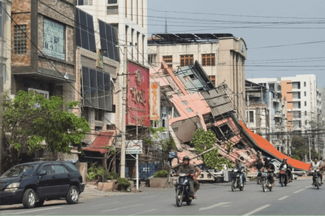
At least 50 people were reported injured, with one hospital handling dozens of cases. Officials also received reports of fires, damaged buildings, broken roads and bridges. Parts of Kumamoto Castle’s stone walls collapsed again, adding fresh damage to a landmark still associated with the destructive 2016 Kumamoto earthquakes.
About 40,000 homes lost electricity, according to Kyushu Electric Power. Mobile services were disrupted in some locations because of power shortages and transmission failures. More than 150,000 residents were instructed to move to evacuation centres while local authorities assessed unstable buildings, blocked roads and the risk of landslides.
Transport across Kyushu was badly affected. JR Kyushu suspended services, including Shinkansen bullet trains, while Kumamoto airport closed its runway and flights were diverted or cancelled. A goods train reportedly derailed, and major road cracks made some routes unsafe. Travellers should verify rail and flight status directly rather than relying on an earlier timetable.
Factories also moved quickly. TSMC evacuated workers from its nearby semiconductor plant as a precaution, while Sony and Fujifilm reportedly cleared staff from facilities in the region. Nuclear regulators said no irregularities had been found at three nearby nuclear power stations.
Why Do Magnitude Reports Differ And What Happens Next?
The 7.1 figure comes from JMA and remains the number used in Japanese emergency reporting. The USGS earthquake event page initially listed 7.1 before revising its estimate to 6.8 after reviewing additional seismic data. Such differences can occur because agencies use separate instruments, calculation methods and magnitude scales.
The earthquake was shallow, at roughly 10 kilometres deep, which can produce severe surface shaking near the epicentre. JMA officials warned that seismic activity remained elevated and asked residents in strongly shaken areas to remain ready for another major tremor. The highest caution is needed around cracked buildings, retaining walls, steep slopes and roads already weakened by the first shock.
People returning home should check for gas smells, damaged wiring, fallen furniture and new cracks before entering. Coastal residents should not treat the lifted advisory as permission to ignore future alarms. A strong aftershock can prompt another notice, so official alerts should take priority over social-media clips or unverified evacuation messages.
The immediate tsunami risk has eased, but recovery across Kumamoto and neighbouring parts of Kyushu may take longer. Damage inspections, restored power, reopened rail lines and verified casualty figures will determine how quickly normal services return.
Frequently Asked Questions
Which Japanese areas received the tsunami advisory?
The advisory covered coastal areas around Ariake and Yatsushiro seas across four southwestern Japanese prefectures.
Was a tsunami recorded after the Japan earthquake?
No tsunami was detected, and authorities lifted the advisory within roughly two hours after issuance.
Was the earthquake magnitude 7.1 or 6.8?
JMA measured 7.1, while USGS later revised its estimate downward to magnitude 6.8 after review.
How many people were injured in the earthquake?
At least 50 injuries were reported, alongside fires, blackouts, damaged buildings, roads and bridges locally.
What should residents do after the advisory is lifted?
Residents should follow JMA alerts and immediately avoid damaged structures, slopes, coastlines and unnecessary travel.