

The Central Water Commission has warned Alipurduar in West Bengal and Dhubri in Assam that the Sankosh could rise suddenly following a reported lake outburst in Bhutan. Officials in Alipurduar have begun relocating residents from vulnerable riverbanks.
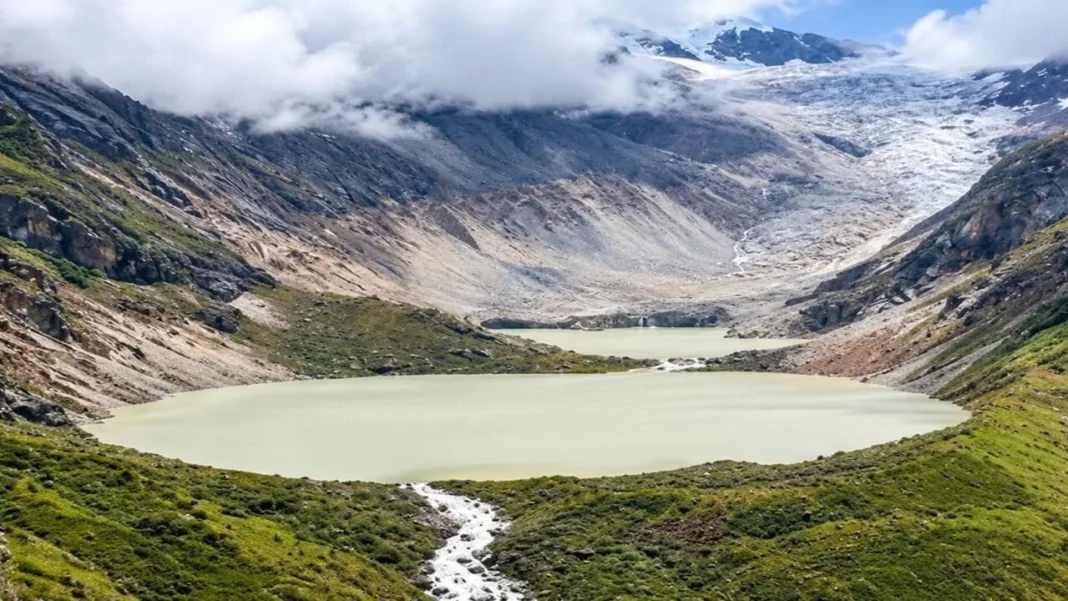
The emergency follows reports of a water release from Shintaphu Lake on 29 October 2026. Bengal has opened relief shelters, while Assam is monitoring the river and keeping response teams ready.
Key Highlights
- The central advisory warns of a possible river surge in Alipurduar and Dhubri.
- Temporary shelters in Bengal include school buildings.
- Assam is monitoring vulnerable locations in Dhubri and Kokrajhar.
- Bhutan has reported infrastructure damage; assessments remain incomplete.
Where Does The Sankosh Flood Alert Apply?
Shintaphu drains into the Mo Chhu, which joins the Pho Chhu at Punakha to form the Punatsangchhu. Farther south, this river enters India as the Sankosh, connecting the upstream release with downstream communities.
The central warning identifies specific downstream districts. Local announcements extend preparedness to other vulnerable areas:
| Location | Reported Position |
| Alipurduar, West Bengal | Central advisory; residents moved from exposed riverbank settlements |
| Cooch Behar, West Bengal | Local warnings around Tufanganj and Boxirhat |
| Dhubri, Assam | Central advisory and preparations for downstream impact |
| Kokrajhar, Assam | Monitoring across vulnerable revenue circles |
| Darjeeling Region And Jalpaiguri | Wider precautionary appeals in North Bengal |
These locations appear in reported advisories and preparedness announcements: www.news9live.com. For a particular household, the useful information is the village-level evacuation instruction and designated shelter, rather than the district name alone.
How Many People Have Left Their Homes?
Alipurduar Superintendent of Police Amit Kumar Shaw described the scale of the relocation in his briefing to ANI:
- Officials had accommodated around 4,000–5,000 people in temporary shelters, including schools.
- More than 6,000 others had moved to safer places outside those shelters.
- Relief preparations covered dry food, drinking water and toilet facilities.
Those figures account for reports of more than 10,000 people relocating. They record precautionary evacuations, rather than confirmed loss of homes. ANI’s official video contains Shaw’s briefing.
Assam had not reported the same evacuation activity. Its disaster management authority said no evacuation had begun in Dhubri or other Lower Assam districts in the morning update. Teams remained ready despite the absence of a reported river-level rise at that stage.
What Happened In Bhutan, And What Remains Unconfirmed?
The reported outburst occurred below Wakila Mountain in Bhutan’s Gasa district. Floodwater damaged the Gasa Tshachu hot-spring facilities after authorities evacuated the area. Morning reports recorded no deaths or injuries there.
The flood also disrupted infrastructure farther downstream. Debris reached the Punakha–Gasa Highway, and partial damage stopped a solar-powered irrigation system in Punakha from operating. Officials were still establishing the full losses.
During a glacial lake outburst flood, stored water escapes suddenly, often when a natural barrier fails. The flow can carry rocks and timber through valleys, increasing the threat to bridges and roads.
The precise trigger at Shintaphu remained unconfirmed in morning reporting. A general list of possible causes cannot establish which process started this event, and upstream damage alone cannot predict flood depth at an Indian settlement.
What Should Residents Do During The Warning?
The India Meteorological Department’s flood guidance puts evacuation instructions and safe movement first. For households preparing to leave:
- Have waterproofed documents and the emergency kit ready to carry.
- Use the shelter location and access route specified in the local notice.
- Charge mobile phones while power remains available.
- Keep away from flooded roads, damaged electrical lines and fast-moving water.
An evacuation order is the signal to leave. Waiting beside the river to judge the flow adds no reliable information about what may arrive from upstream. IMD says residents should return home only when officials allow it.
For households under an evacuation order, the next step is reaching the designated shelter. Follow police and district announcements for route changes and permission to return.
FAQs
Can floodwater arrive without heavy local rain?
Yes. Floodwater released higher in the basin can travel downstream even without heavy rain locally. A dry neighbourhood does not remove the need to follow official warnings.
Does a red alert mean every district is flooded?
A red alert indicates the reported threat along the Sankosh system. It does not establish that floodwater has entered every settlement across all the districts receiving warnings.
Can travellers use the Punakha–Gasa Road?
Authorities have restricted affected stretches following flood damage. Confirm access for the exact journey before departure, since conditions elsewhere along the highway cannot establish that route’s safety.
Where should families find evacuation and shelter details?
Use district administration and police announcements, including local loudspeaker messages. Verify the place and time attached to any forwarded notice, particularly before following an evacuation route.
India Floods and Landslides: Latest Updates, Risks and Safety Alerts
1. What Happened During the Recent Sikkim Landslide?
2. Why Did the Mandakini River Flood Chitrakoot?
3. How Many People Were Evacuated During the UP Floods?
4. Why Are Flash Floods Increasing Across India?
Uncover the connection between extreme rainfall and flash flood risks in India.
5. How Can People Prepare for Sudden Floods?