

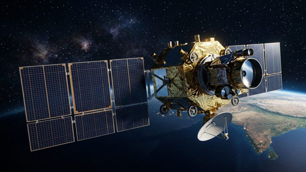

India is preparing to place a very different kind of Earth-observation camera high above the planet. ISRO will launch EOS-05 aboard GSLV-F17 from the Second Launch Pad at Sriharikota at 2:55 am IST on September 4, 2026. ISRO describes EOS-05 as India’s first imaging satellite from geosynchronous orbit.
Instead of racing over the surface like many low-Earth-orbit spacecraft, it is designed to keep returning its view to the Indian region from roughly 36,000 km above Earth. That higher position sacrifices some fine ground detail, but it gives scientists something valuable during fast-changing events: frequent, wide-area pictures without waiting for another satellite pass.
What Is EOS-05 And Why Is This Launch Different?
EOS-05, also referred to in reports as GISAT-1A, is an Earth-observation spacecraft built for repeated regional imaging. The official ISRO mission page says GSLV-F17 will first place it into a Sub-Geosynchronous Transfer Orbit, not directly into its final working orbit. The spacecraft must then use its own propulsion to raise and reshape that orbit.
This is also the 19th flight of India’s Geosynchronous Satellite Launch Vehicle. The rocket will fly with a four-metre ogive composite payload fairing and lift off from the Satish Dhawan Space Centre. ISRO said the assembled vehicle was moved from the Vehicle Assembly Building to the Umbilical Tower on August 28 as final launch preparations continued.
Key launch details are:
- Launch date: September 4, 2026
- Liftoff time: 2:55 am IST
- Rocket: GSLV-F17
- Launch pad: Second Launch Pad, Sriharikota
- Initial destination: Sub-Geosynchronous Transfer Orbit
- Mission role: Frequent Earth imaging of India and nearby regions
ISRO has also posted the launch announcement through its official X post, while the agency’s official EOS-05 livestream page will carry coverage before liftoff.
How Will EOS-05 Watch The Same Region From Nearly 36,000 Km?
The trick is orbital timing. A spacecraft near geosynchronous altitude takes about one sidereal day to circle Earth, closely matching the planet’s rotation. From the right orbit and longitude, its view changes far less than that of a polar-orbiting satellite moving only a few hundred kilometres overhead.
That means EOS-05 can keep a broad part of the Indian subcontinent inside its field of regard and revisit chosen areas much more frequently. A low-orbit satellite may provide sharper images, but it quickly disappears beyond the horizon and must wait for another pass. EOS-05 trades some spatial detail for time.
Geosynchronous Does Not Simply Mean “Floating Still”
The satellite is not parked motionless in space. It is moving at orbital speed while Earth turns below. A near-geostationary operational position can make a spacecraft appear almost fixed over one longitude. ISRO’s public mission material uses the term geosynchronous imaging satellite, so the exact operational geometry should be described carefully until the agency publishes final post-launch orbital details.
What Can EOS-05 See And Why Could Frequent Images Help?
The GISAT design family uses multispectral and hyperspectral imaging, allowing instruments to record reflected energy across several wavelength bands rather than producing only ordinary colour photographs. Recent mission reporting describes frequent imaging of the Indian subcontinent, with rapid revisits intended for selected areas.
Frequent observation can be particularly useful when conditions change between conventional satellite passes. Cyclones shift track, floodwater spreads, wildfire fronts move, and crop conditions evolve over days or weeks. Repeated regional images can help agencies compare what changed and where. ISRO and other reports list disaster monitoring, agriculture, environmental observation and weather-related applications among the areas that could benefit.
EOS-05 is not a replacement for every other Earth-observation satellite. Optical sensors still face cloud cover, and high-altitude imaging cannot match the finest detail available from some lower-orbit cameras. Its strength is persistence. Used alongside polar-orbiting radar and weather satellites, it can add another time-sensitive layer to India’s observation network.
Why The September 4 Mission Is A Bigger Test For ISRO
EOS-05 carries some history. India’s earlier GISAT-1, later designated EOS-03, was lost during the GSLV-F10 mission in August 2021 after the cryogenic upper stage failed to ignite normally. EOS-05 is therefore a renewed attempt to establish the imaging capability that mission was meant to provide. ISRO’s spacecraft records list EOS-03 as an unsuccessful launch.
The launch also ends a roughly seven-month gap in Indian orbital launches following the unsuccessful PSLV-C62/EOS-N1 mission in January 2026. The Indian Express report on ISRO’s return to flight notes that September 4 will mark the agency’s return to the launch pad after that setback. That puts extra attention on GSLV-F17, its cryogenic upper stage and the satellite’s later orbit-raising manoeuvres.
If the mission works as planned, India will gain a new type of observing platform: one built less around the sharpest single picture and more around returning to the same broad region again and again.
FAQs
When will ISRO launch EOS-05?
ISRO plans EOS-05’s launch for September 4, 2026, at 2:55 am IST from Sriharikota.
What rocket will carry EOS-05?
GSLV-F17 will carry EOS-05 and initially inject the spacecraft into a Sub-Geosynchronous Transfer Orbit safely.
How high will EOS-05 operate above Earth?
EOS-05 should operate roughly 36,000 kilometres above Earth after completing planned orbit-raising manoeuvres successfully.
Why can EOS-05 revisit India more frequently?
Its orbital period matches Earth’s rotation, keeping the Indian region visible for repeated imaging passes.
Will EOS-05 replace low-Earth-orbit imaging satellites?
No. It complements lower-orbit satellites by providing frequent wide-area coverage instead of maximum spatial detail.