

India’s Earth observation satellite, EOS-05, has completed its final orbit-raising manoeuvre and is nearing routine imaging. ISRO’s final orbit update said the spacecraft reached an estimated 34,903 km by 35,884 km orbit on September 7, with its health normal. Once its cameras are checked and activated, the satellite is expected to watch broad parts of India about every 30 minutes and revisit selected priority areas in roughly five minutes. That could give disaster agencies faster image sequences during cyclones, floods, cloudbursts and forest fires, although pictures will still need radar, sensors and field reports.
What Has Happened To EOS-05 After Its September 4 Launch?
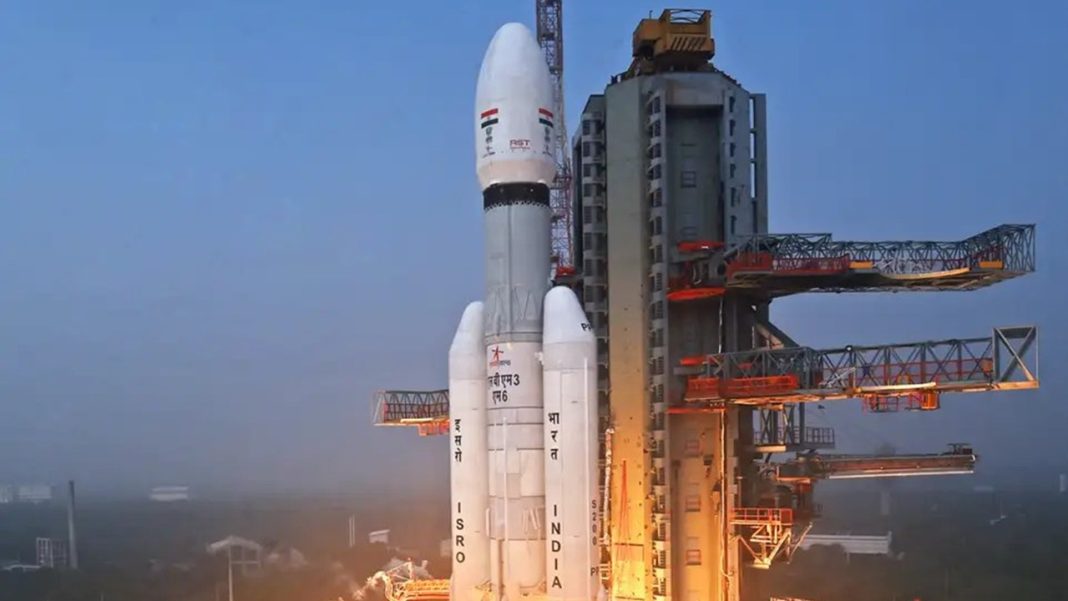
GSLV-F17 lifted off from the Satish Dhawan Space Centre at Sriharikota at 2:55 am IST on September 4, carrying the roughly 2,367 kg EOS-05. ISRO’s mission page describes it as India’s first imaging satellite designed for geosynchronous orbit. The rocket first placed it in a sub-geosynchronous transfer orbit, after which the spacecraft used its Liquid Apogee Motor for three orbit-raising operations.
The first manoeuvre came on September 5, the second on September 6 and the final burn lasted 1,247 seconds on September 7. ISRO had earlier said the spacecraft was being moved towards the 85.5° East orbital slot. System and payload checks are still required before regular imaging begins.
Key Points:
- EOS-05 can keep the Indian region in view for long periods from near 36,000 km.
- Selected disaster zones may be revisited around every five minutes after commissioning.
- Broad Indian landmass imagery is expected at roughly 30-minute intervals.
- The mission follows EOS-03, a similar geo-imaging attempt lost during GSLV-F10 in August 2021.
- Disaster support is expected to cover cyclones, floods, forest fires, agriculture and environmental monitoring.
Why Could A Five-Minute Revisit Be Useful During Disasters?
Speed is the advantage. A low-Earth-orbit imaging satellite may produce sharper pictures, but it cannot continuously remain above the same region. EOS-05 trades some spatial detail for higher temporal coverage, letting agencies compare a fast-changing location repeatedly rather than waiting for another orbital pass.
During a cyclone, consecutive images could help analysts follow cloud structures, coastal changes and storm movement alongside IMD radar and INSAT weather data. During floods, frequent views could show how inundation expands across river basins or low-lying districts. Forest-fire monitoring could also benefit when smoke plumes or active burn zones move quickly.
ISRO’s disaster-management services already use satellite data for cyclone tracks, flood inundation, forest-fire alerts, landslides and emergencies. EOS-05 could add a persistent optical view to that network rather than replace it.
Will EOS-05 Actually Make Emergency Warnings Five Minutes Faster?
Not automatically. A five-minute imaging opportunity does not mean citizens will receive a warning five minutes later. Images must be captured, transmitted, processed, analysed and passed into operational systems. Clouds can also block visible and infrared observations, while radar satellites can work through cloud cover and darkness more effectively.
The gain should come from frequent evidence during rapidly evolving events. Emergency teams may see a flood boundary, fire plume or damaged area change between successive frames instead of relying on widely separated snapshots. That can support quicker mapping and resource deployment when ground access is poor.
The satellite becomes most useful when its imagery reaches the National Remote Sensing Centre, IMD, disaster authorities, state control rooms and forest departments. A 2026 Department of Space parliamentary reply says India already runs near-real-time satellite monitoring for floods, landslides, cyclones, forest fires and glacial lake outburst floods.
Prime Minister Narendra Modi also highlighted the mission in an official X post after launch, calling EOS-05 India’s first imaging satellite from geosynchronous orbit.
What Comes Next For EOS-05 And India’s Disaster Tracking?
Commissioning comes next. Engineers must complete health checks, stabilisation, payload testing and calibration before operational products start flowing. The first released images will show how well the planned rapid revisit performs over Indian terrain and weather systems.
EOS-05 also closes a long gap after the unsuccessful EOS-03 mission in 2021. If the new spacecraft delivers reliable five-minute targeted imaging, India gains another layer between high-frequency meteorological observation and higher-resolution passes from other Earth-observation satellites.
Its value will depend on how quickly repeated pictures reach forecasters and emergency responders, and how well they are combined with radar, river gauges, weather stations and field information.
FAQs
What is EOS-05?
EOS-05 is India’s first geosynchronous imaging satellite built for frequent Earth observation over Indian regions.
How often can EOS-05 revisit a disaster hotspot?
Selected priority locations may be imaged every five minutes once EOS-05 completes commissioning and calibration.
Can EOS-05 track cyclones by itself?
No, cyclone monitoring will combine EOS-05 imagery with INSAT data, radar, models and observations nationwide.
Will EOS-05 work during heavy cloud cover?
Optical imaging can face cloud limits, so radar satellites remain valuable during storms and flooding.
When will EOS-05 become fully operational?
ISRO has not announced a final operational date; system checks and payload activation must finish.