

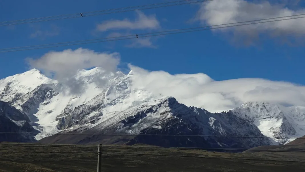

The Himalayas are nearing dangerous climate thresholds as glaciers retreat, glacial lakes expand and unstable slopes expose downstream communities to sudden floods. A September 2026 report says Himalayan glaciers are losing mass 65% faster than a decade ago. India assessed 189 high-risk glacial lakes in 2025, including 56 rated “very high risk”.
The warning comes after another deadly Himalayan disaster in Nepal in August 2026 and has renewed focus on villages, roads, hydropower projects and river valleys below high-altitude lakes. Scientists are especially concerned about Glacial Lake Outburst Floods, or GLOFs, where stored water can rush downstream after a natural ice or moraine barrier fails.
Key Highlights
- India assessed 189 glacial lakes as high risk in 2025, with 56 rated very high risk.
- Himalayan glaciers are losing mass 65% faster than they were a decade ago.
- The region could approach “peak water” around mid-century as glacier-fed river flows begin declining.
- India is expanding lake monitoring, early-warning work and GLOF preparedness across Himalayan states.
What Does The New Himalayas Report Warn About?
Systemiq’s Prosperous and Resilient Himalayas report, available on its official report page, was published with the Integrated Mountain Initiative and supported by the Rockefeller Foundation. ICIMOD and the G.B. Pant National Institute of Himalayan Environment provided technical contributions.
The report says Himalayan water underpins more than 20% of India’s GDP. It warns that glacier retreat, thawing permafrost, unstable slopes, black carbon and growing glacial lakes can combine into cascading hazards.
One striking figure is the speed of ice loss. Glacier mass loss is now 65% faster than a decade earlier. Systemiq also says roughly one-third of Himalayan glacier melt is driven by black carbon, much of it linked to pollution sources such as brick kilns on the plains.
Why Could 189 High-Risk Glacial Lakes Threaten Communities?
Glacial lakes form or enlarge as ice retreats and meltwater collects behind moraine, rock or ice barriers. Most will not suddenly fail, but lakes above populated valleys become dangerous when avalanches, rockfalls, earthquakes or extreme rainfall disturb those barriers.
The 189 high-risk lakes are not 189 disasters on a fixed timetable. They are priority sites for monitoring, field surveys and downstream planning. Of them, 56 have been classified as very high risk.
India already has a grim example. In October 2023, South Lhonak Lake in Sikkim burst, sending floodwater into the Teesta basin. ISRO’s satellite analysis found that about 105 hectares of lake area drained during the event, showing why remote monitoring is now central to GLOF preparedness. That disaster also exposed how a high-altitude lake failure can damage energy infrastructure and communities far beyond the lake itself.
The wider trend is also clear. ISRO previously identified 676 expanding glacial lakes across Indian Himalayan river catchments from long-term satellite records, including 130 situated within India.
How Is India Responding As The Himalayas Keep Changing?
On September 3, 2026, the Union Home Secretary reviewed GLOF and avalanche preparedness with Himalayan states and agencies including NDMA, CWC, IMD and DGRE. The government review covered vulnerable-lake monitoring, flow paths, early warnings, evacuation plans and last-mile alerts.
Sikkim is becoming an important testing ground. A July government update
said the state received an indigenous autonomous glacial-lake profiling and risk-assessment technology suite developed through MeitY-backed research. In September, state officials said 16 lakes had been identified as high risk after detailed screening.
India has also approved a ₹150 crore National Glacial Lake Outburst Flood Risk Mitigation Project covering Arunachal Pradesh, Himachal Pradesh, Sikkim and Uttarakhand.
Why “Peak Water” Changes The Bigger Picture
The report warns that the region is moving toward “peak water”, when glacier-fed river flows stop increasing and begin declining as the ice reserve shrinks. That shift could affect irrigation, drinking water, hydropower and industries far beyond the mountains.
Better sensors, cross-border data sharing, safer construction and workable evacuation routes can reduce disaster losses. Yet the bigger race is against a landscape changing faster each year. For India, the key question is whether risk maps, lake monitoring and warnings can keep pace before the next dangerous lake crosses its own threshold.
FAQs
Can all 189 high-risk glacial lakes burst suddenly?
No, each lake has different terrain, triggers, stability, exposure, and downstream populations requiring individual assessments.
What is a Glacial Lake Outburst Flood?
It is sudden flooding when glacial-lake water escapes after an ice or moraine barrier fails.
Which Indian state faced a major recent GLOF?
Sikkim faced the South Lhonak outburst in October 2023, damaging settlements, roads, and hydropower infrastructure.
Why are Himalayan glacial lakes growing?
Retreating glaciers create basins and release meltwater, allowing existing high-altitude lakes to expand over time.
Can early-warning systems stop a GLOF?
They cannot prevent outbursts, but detection and alerts can give downstream residents crucial evacuation time.
Stay Updated With These Key Stories
Could Vande Bharat Transform Kashmir Connectivity?
Check out what faster trains on the Chenab Bridge could mean for Kashmir’s rail network.
Which Uttarakhand Routes Face Flash Floods?
Find out which travel routes may be risky amid warnings across eight districts.
How Does A Western Disturbance Work?
Uncover the causes, effects, and latest forecast behind this important weather system.
Will Western Disturbance Bring North India Relief?
See how expected rain from April 16 could ease conditions across northern regions.
How Is Mumbai Tackling Climate Risks?
Look into the changes being made to Mumbai’s flood, heat, and pollution risks.